Top 5 Hiking Trails in Ontario
It’s not always easy doing a top 5 or 10 list. It really depends on the scope of where/what the reviewer has experienced. When it comes to hiking though, over the years I have been on several from Southern, and Eastern Ontario all the way to Northwest Ontario. And, what I find from popular review sites for hiking, is many of the popular trails are close to the city. As an example, I have been on 7 of the top 10 hikes for Ontario according to All Trails. Only two of them I would put on my top 10.
Personally, I need a hike that has a buildup that leads to a viewpoint or some place of significance. Preferably with some challenges, although not always required. Sometimes the distance might be the challenge itself. Then again, the Cup and Saucer trail on Manitoulin Island is listed as a moderate challenge. I completed that hike with my daughter who was 5 years old at the time. To each their own.
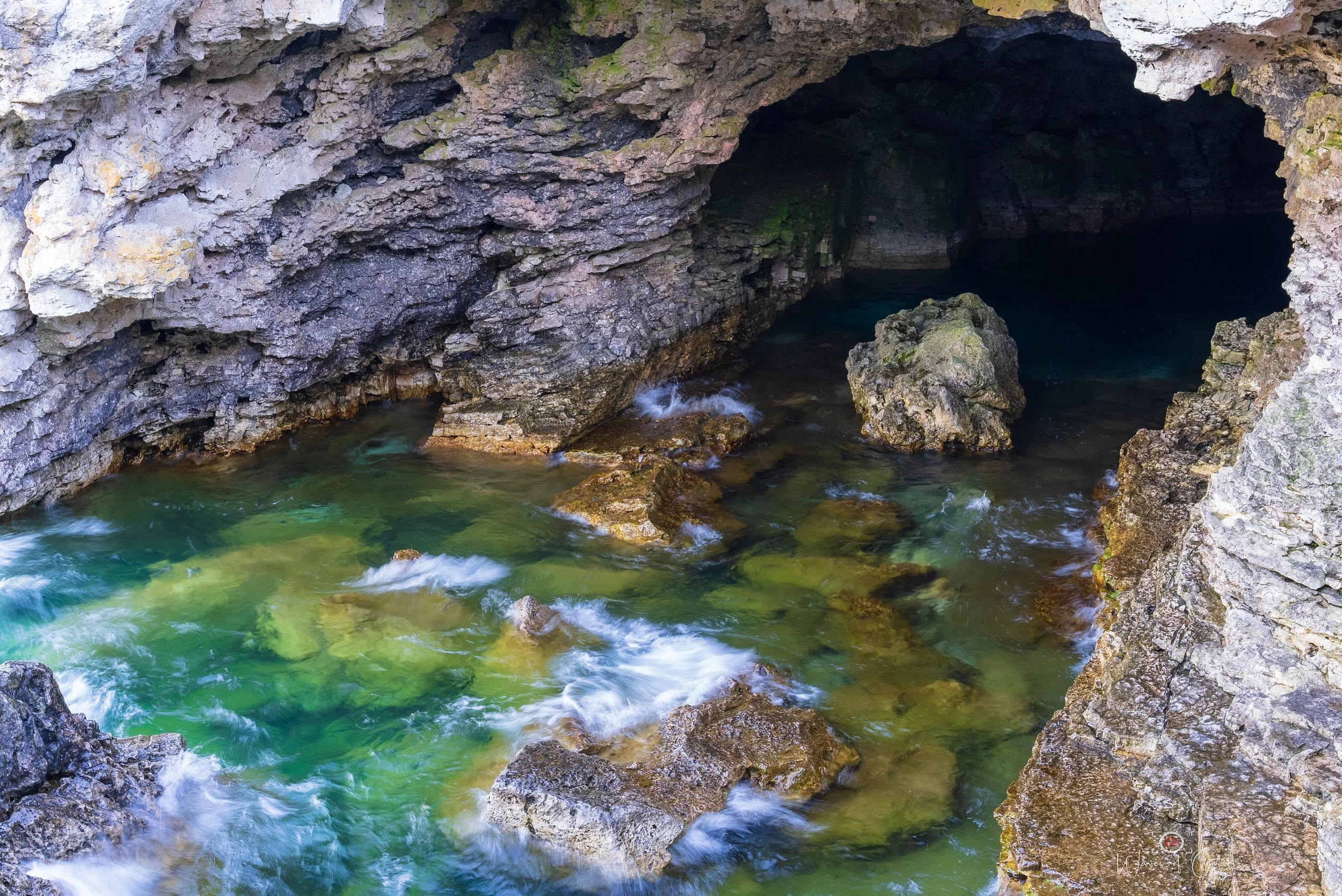
5. Stormhaven to the Grotto, Bruce Peninsula National Park
Stormhaven is a backcountry campsite at Bruce Peninsula National Park. Your hike will start on rocky terrain by the water. After a while, you will have the option to continue to stay on the rocks for a bit longer or make your way toward the forest. I stayed on the rocks, then towards the cliffs with a few difficult climbs and balancing on the edges. The official trail is listed as from Halfway Log Dump to the Grotto, but I started from my campsite instead, which is a bit closer to the Grotto.
The main challenge, especially if you’re packing camera or camping gear, is going down to the Grotto itself. In the summer months, this location is quite popular. When I did this particular hike it was in October, and I only came across a few people. Plus, most people who visit the Grotto would be parking close by at the lot, and not doing the complete hike from Stormhaven or Halfway Log Dump.
The hike has challenges (listed as hard according to All Trails), and I don’t think that even considers climbing down to the Grotto. Be careful if you do decide to climb down, I’ve heard of people slipping and I only recommend it for experienced hikers with adequate footwear and ideally with some help. If you do not want to climb down, the view from the top ain’t so bad either.
Distance: ~5 KM point-to-point, Difficulty: Hard
The Grotto, Bruce Peninsula National Park
4. Centennial Ridges Trail, Algonquin Provincial Park
Located in beautiful Algonquin Provincial Park, the Centennial Ridges trail is known as a top 10 hike in Ontario, and with good reason. It has some challenges with rewarding viewpoints. I highly recommend visiting in Fall. Algonquin is extra special compared to other parks during this time of year.
If you’re not up for the longer hike, a good alternative is the Algonquin Lookout Trail, which is only about 2 km total with some almost equally rewarding views.
Distance: ~11 KM out-and-back, Difficulty: Medium
Algonquin Provincial Park at sunset
3. Southern Headland Trail, Pukaskwa National Park
Pukaskwa National Park is another special place. The remote location, quiet, natural beauty, and ruggedness even inspired me to make a few music tracks. I personally love the Lake Superior area in Ontario so a coastal trail is right up my alley. But you don’t need to do the entire 50-60 KM multi-day hike. Even just for certain sections and experiencing some of the smaller hikes such as this one is more than good enough. For me personally, it wasn’t about the hike itself but rather reaching the end, sitting at the edge of the rocks to relax and enjoy the view. While for the most part, this is an easy trail. There is a section though that’s quite tight to pass through, especially if you’re packing a lot of gear.
Distance: ~3 km out-and-back (about 55 km for the entire Coastal trail), Difficulty: Easy
Hiking at Pukaskwa National Park
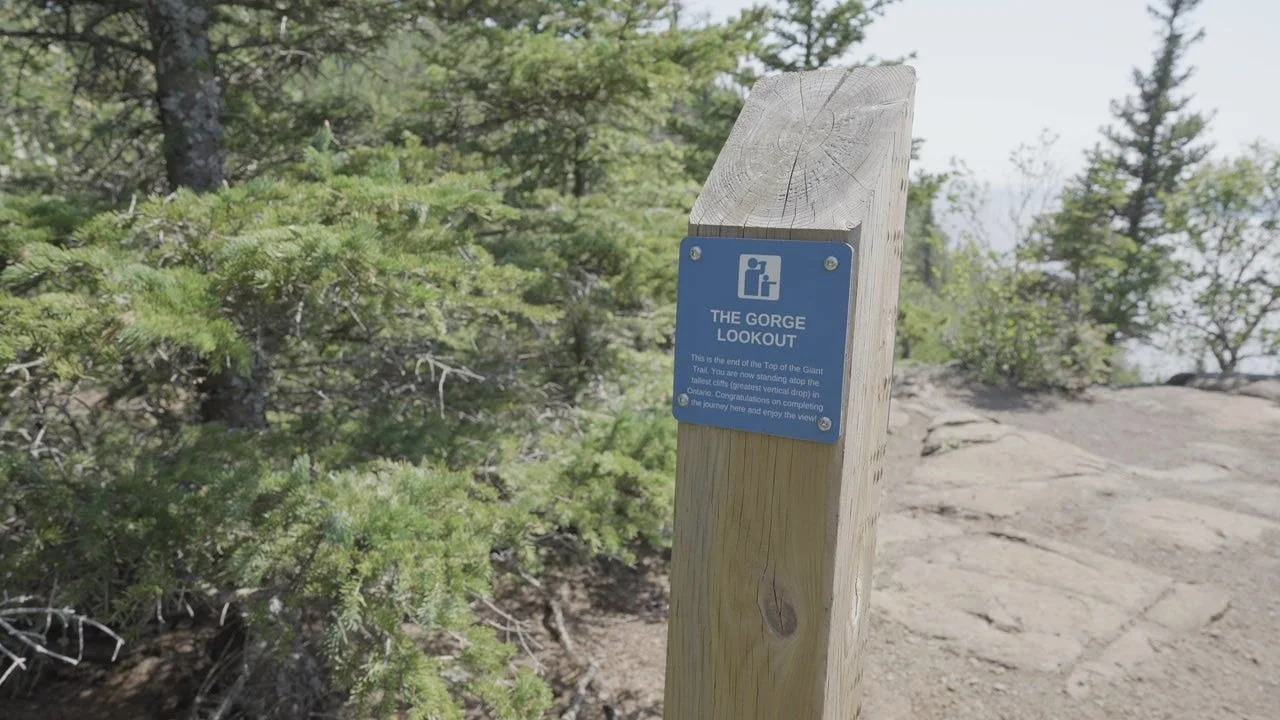
2. Top of the Giant, Kabeyun Trail, Sleeping Giant Provincial Park
The Top of the Giant via Kabeyun Trail is an incredible hike from beginning to end. It’s about a 23 km out-and-back trail that has it all: rewarding viewpoint, uphill, downhill, and side trails along the way (Sea Lion trail, add another 2 km or so).
The first half of the trail is quite flat. Some even bike it but it can get quite muddy. After that, it’s a constant grind to the top. Pack light if you can. Also, if you’re afraid of heights, you might want to think twice before doing this hike. Or, at least stay away from the edges when at the top. There is a point from the top of the lookout where it’s about a 1 km drop straight to the bottom. It can get quite windy as well.
Distance: ~23 km out-and-back, Difficulty: Medium
Top of the Giant, The Gorge Lookout (warning?), tallest cliff in Ontario
“The Gorge”, Top of the Giant
Top of the Giant, alternate lookout point
1. Lion’s Head Lookout Trail
Finally, the number one hike in Ontario that I would recommend. It can be accessed via Cemetary Road or the McCurdy parking lot, which is small so arrive early. I recommend The McCurdy parking lot especially if you want to avoid a longer hike (or not if wish to hike a bit longer). I have done both, but prefer spending time at the top of the lookout instead. I reached the top both times at midday, so I did not get any exciting photography. But that’s OK, it wasn’t my main focus when doing the trail. It has some challenges, but overall quite easy if it isn’t muddy. What I found puzzling is the number of people who were lost. I didn’t even come across many hikers there but half of them had no idea how to reach the lookout, some even turned around. Just follow the trail markers and you’re fine. You’ll be rewarded with stunning views.
I like to stick around the Lion’s Head area once I complete my hike for some Astrophotography. The dark skies along with some interesting viewpoints along Bruin St add to an adventurous day.
Distance: ~6.5 km out-and-back, Difficulty: Easy to Medium
Nightscape photography at Lion’s Head
While the above list is my top 5 that I would recommend to hikers, my favourite of them all is the Cup and Saucer, Manitoulin Island. It was the first “big” hike I went on with the family. My daughter, who was 5 years old at the time completed the entire hike with ease. It was truly a proud father moment! My son, two years old at the time, even completed almost half of it until the wife had to take him back. It’s moments like those that make certain hikes and locations extra special.


